
3D LASER SCANNING, ALSO KNOWN AS HIGH DEFINITION SURVEYING (HDS), IS QUICKLY BECOMING THE STANDARD METHOD TO CAPTURE EXISTING CONDITIONS, DURING CONSTRUCTION MEASUREMENTS, AND RECORD A FINAL BUILT PROJECT.


3D scans provide unparalleled accuracy and a wealth of spatial coordination between owners, project managers, architects, engineers, contractors, and facility managers.
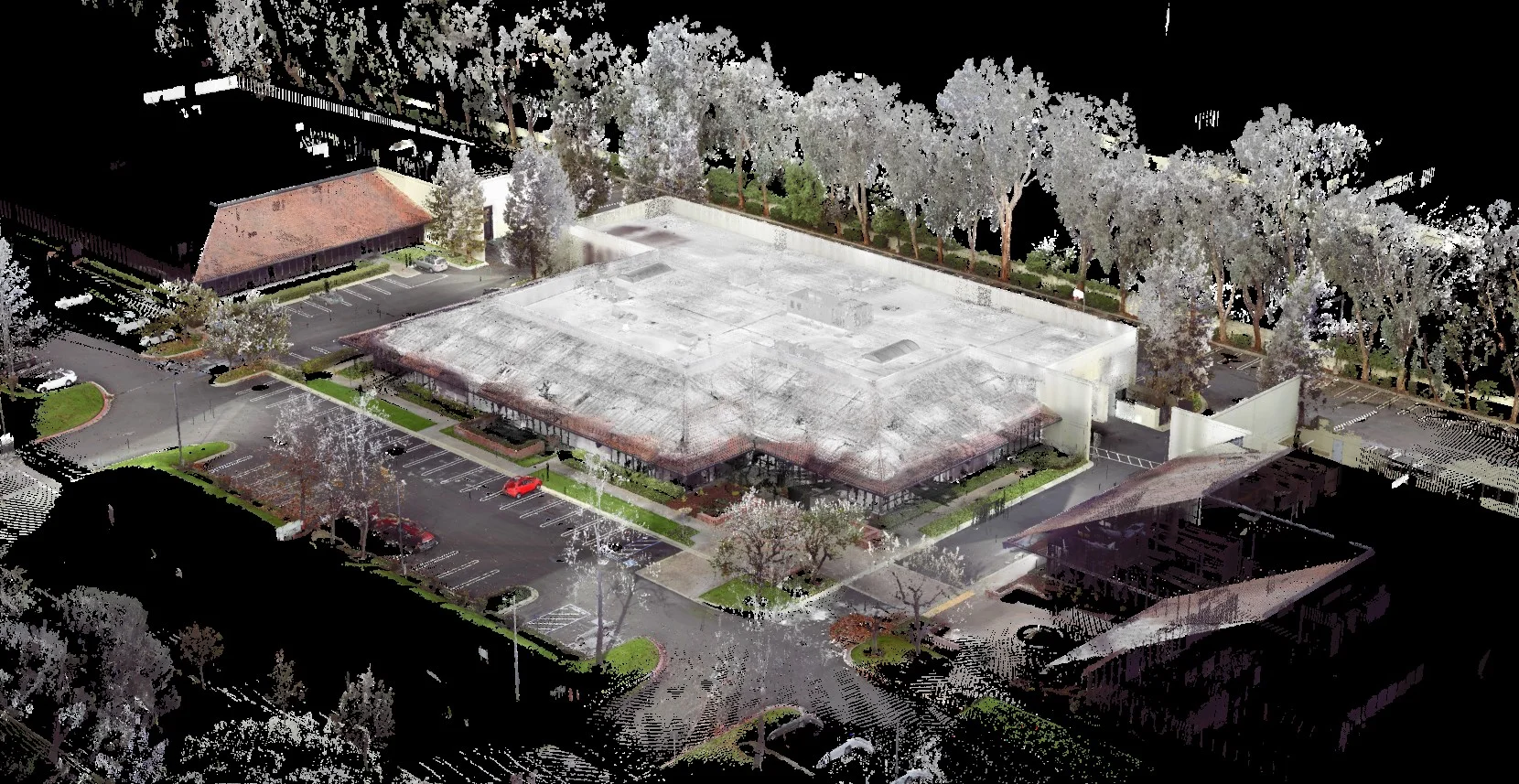
The data Locus Laser Scanning collects from our scans is assembled into a full color point cloud that contains billions of point measurements. A project team can utilize the point cloud in ways no traditional surveying or tape measure can. The project team can be given web access to view and take direct measurements and literally "walk through" the project remotely.
One of the many time saving aspects our clients utilize is the ability to visit a project remotely. Because all the scanned spaces are recorded in 360 degrees with full color, a client can look around a room and take accurate measurements without ever leaving their desk.
"SO WHAT CAN A 3D LASER SCAN DO TO HELP MY PROJECT?"
- Complex 3D measurements of existing spaces in a fraction of the time
- Rapid verification of planner alignment of existing walls, floors, and ceilings.
- Insertion of 3D objects into the point cloud for evaluating design options
- Obtain millimeter precision for existing conditions and record drawings
- Conversion of point cloud into 2D CAD base drawings or 3D Revit Model
- Check installation tolerances during construction
- Place notations directly on objects during virtual site walks.
- Record and preserve historical building details
If this sounds to good to be true, then contact Locus Laser Scanning and tell us about your project. Chances are we can help save you both time and money with one of our 3D laser scanning deliverables.